Surface Modeling
Surface models are representations of the ground that may or may not include above-ground objects, and are utilized to perform terrain analysis and used in the generation of orthophotography. Geophex Surveys has worked extensively with surface models from a wide variety of sources and can update existing data surface models or generate a new surface model from LiDAR, image auto-correlation or photogrammetrically in 3D from stereo models.
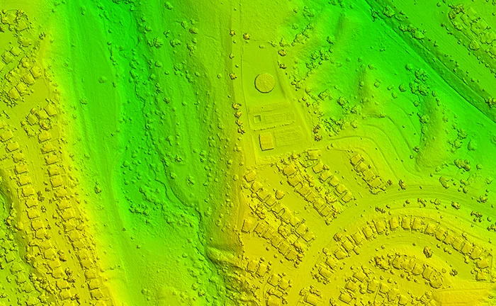
Digital Surface Model (DSM)
Digital Surface Models include the ground and all above-ground objects such as buildings and trees and can be used for change detection, feature elevation information, volume calculations or as a surface for generating true orthophotography from high-overlap photography. Digital Surface Models are usually created from LiDAR data or using auto-correlation methodology.
Digital Terrain Model (DTM)
Digital Terrain Models include only the bare earth and exclude any above-ground objects or features. This type of surface model is used as a base for generating contours and orthophotography, and also provides information on the shape of the terrain which can used for slope analysis or other engineering applications. DTM data can be generated from LiDAR, using image auto-correlation or photogrammetrically from stereo models. Terrain models in point cloud format can also be enhanced photogrammetrically with break lines to improve definition in areas of sharp changes in elevation such as road edges, ditches, embankments, drainage or railway grades.

Colorized Point Cloud
Colorized point clouds are 3 dimensional data sets that represent all surface features and have RGB color value attributes assigned to each elevation point. These can be generated by auto-correlation of stereo imagery or by applying color values to LiDAR data from color orthophotography. Colorized point clouds provide an accurate spatial representation of the ground and above-ground features, with the added quality of color pixel values.

Colorized point cloud showing a mining operation